November / December 2019
From Mexico City I flew to Guatemala City where I met my Swiss travel partner. A tourist van brought us to our first destination Antigua. We met these tourist vans again and again, because the tourists all have about the same route that these vans serve. With the local buses the trips would take much longer, because often several changes would be necessary.
Antigua
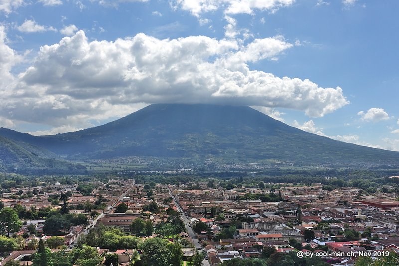
Antigua is a small historic town that lives from tourists, but has remained a lively Guatemalan city where the locals go about their business. Three mighty volcanoes, the Agua (3’766 m), the Fuego (3’763 m) and the Acatenango (3’976 m), surround the city. Volcanic eruptions and floods occurred again and again and during the colonial period the town lost its status as capital after a severe earthquake in 1773. Today Antigua is a provincial town with an intact colonial architecture and cobblestone streets. In 1979 it was recognized as a UNESCO World Heritage Site.
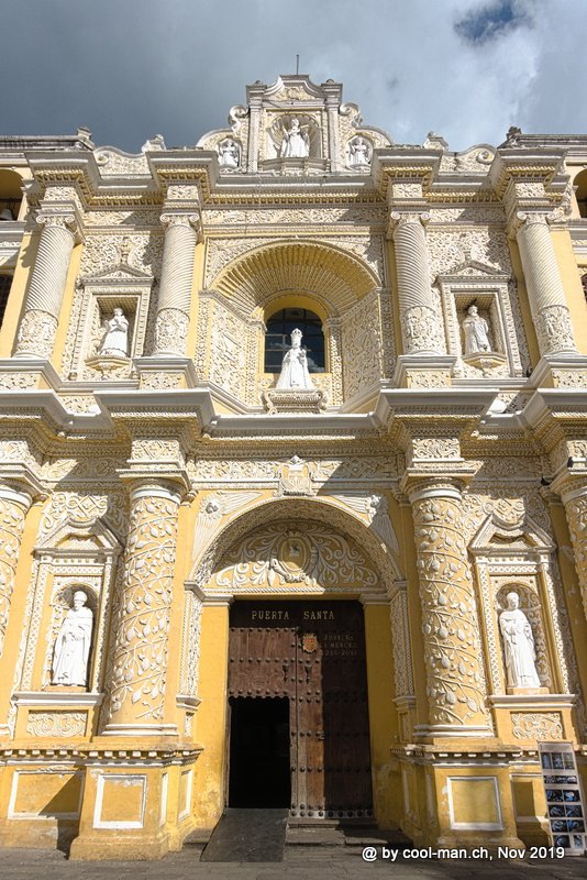
The facade of the church ‘Iglesia y Convento de Nuestra Señora de la Merced’
A typical house in Antigua

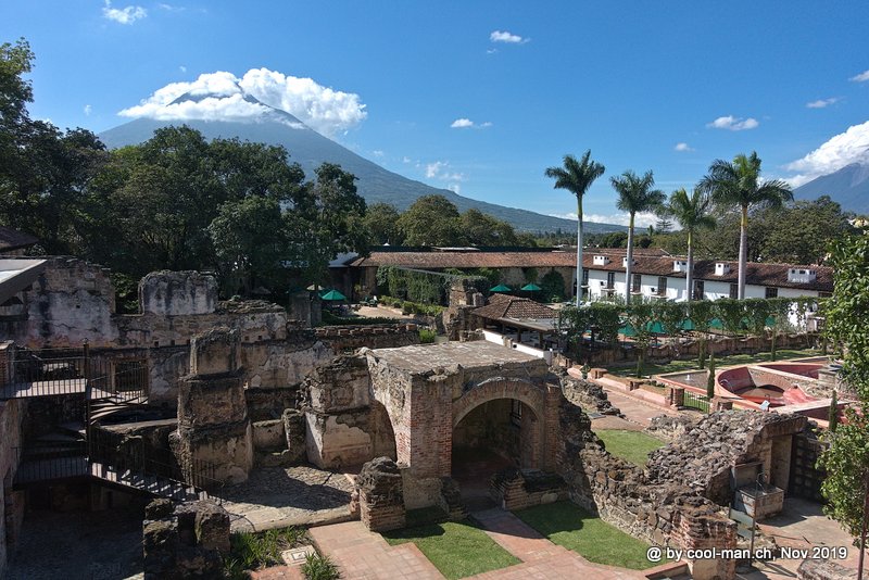
The remains of the Dominican monastery of Santo Domingo, founded in 1538, are today part of the 5-star hotel Casa Santo Domingo.
First we had to get the local currency Quezales. Here I became aware that Guatemala is owned by a few families whose banks charge record-breaking local ATM fees of USD 4 and more. To ensure that the ATMs are used repeatedly, the maximum withdrawal is limited to a modest USD 250.
The city offers cozy cafes, some with excellent coffee, and a wide selection of good restaurants.
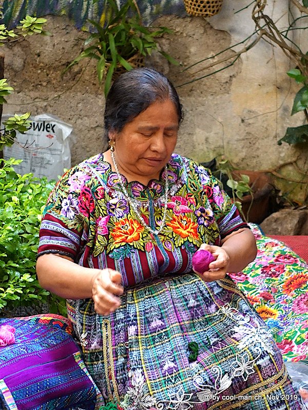
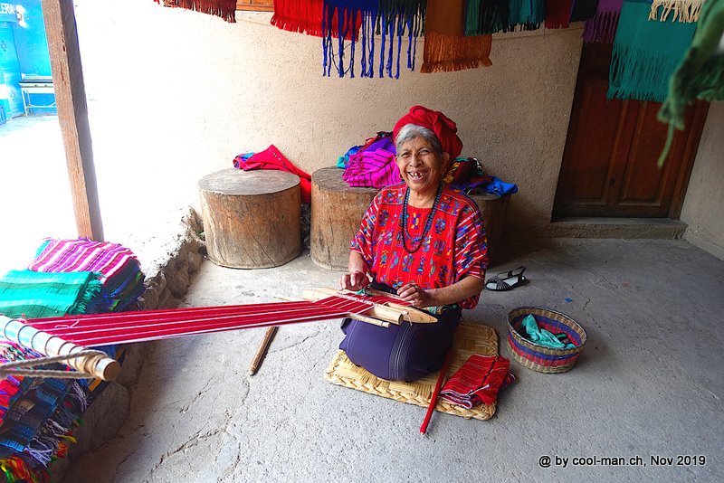
A woman sewing a traditional dress
If I had been on my own, I would have climbed the 3’976 m high volcano Acatenango on a two-day tour, but this was too exhausting for my travel partner, so that we made the easy three-hour hike to a view point with a view to the Pacaya volcano. From a distance, we could observe the lava ejections of this active volcano.
On the way to the Pacaya volcano

The lava ejections of the 2’552 m high Pacaya volcano on one side of the crater

One afternoon we took a walk to the Hill of Crosses (Cerro de la Cruz), where we enjoyed the view over the city and the volcano Agua.
Lake Atitlan
Next we travelled with a tourist van to the lake Lago Atitlan, which is located at an altitude of 1’560 m. With the local bus the trip would have been much more complicated, as hardly any locals travel this route.
We stayed in the small town of Panajachel, which was touristy enough that we found good restaurants. Even an excellent Gelateria offered their homemade ice creams.
The lake is dominated by the three volcanoes Toliman (the highest with 3’158 m), Atitlan and San Pedro. Around the lake there are a few villages, each with its own character. For example, the small village of San Marcos La Laguna is known as a hippie retreat with meditation and yoga offerings.

Unfortunately it was not possible to visit the most important villages in one day with the local boats. Since my travel partner had little time, we therefore booked a tourist tour. As in Antigua, the volcanoes were hardly covered in clouds in the morning. Around noon the clouds came up and covered the mountains, so that we made the trips in the morning.
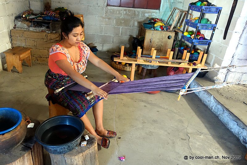
In San Juan La Laguna we could watch this weaver at work.
In a restaurant in San Pedro La Laguna

This salesgirl in Santiago Atitlan just took a break.

Since people were mugged while walking around the lake, this was not an option. An exception was the 10 km walk from the main village Panajachel to the small village San Antonio Palopo, where we could watch women weaving and washing, and mass with the village youth at the the table football.
Traditional weaving
The boys never had a chance.

Chichicastenango
On a Saturday we traveled to the small town of Chichicastenango, 38 km away, because we wanted to visit the famous market in this town on Sunday. Chichicastenango is a local Maya center in the highlands of Guatemala. Almost the entire population here is of indigenous descent.
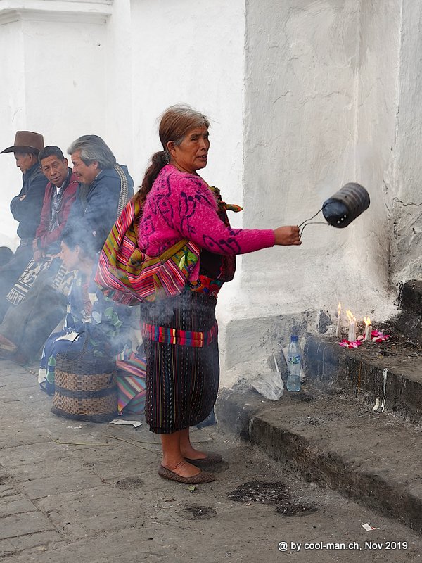
On Saturday we visited the colorful cemetery and a place in a forest where locals pay priests to bring the gods to their side by means of Mayan rituals. These rituals are supposed to help in all kinds of situations in life like exams, business or health.
Like the houses, the cemeteries are very colorful.

A Mayan ritual, which is supposed to help in all kind of situations, was recently held at this site, .

A butcher’s shop: The meat hangs open, unchilled, beside a road.

On the market day on Sunday people from the surrounding villages flocked to the town to stock up on goods, but also to have a chat with acquaintances. This market was one of the highlights of our Guatemala trip. The hustle and bustle and especially the women with their weather-beaten faces and colorful local dresses impressed us.
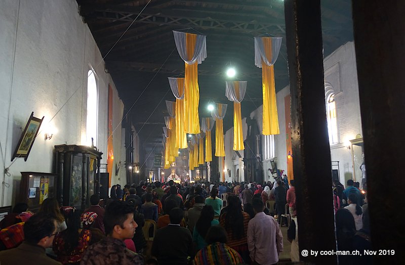
On Sunday market day the mass is very well attended.
In front of the church, this woman waves an incense burner through the air.
Market scenes


This woman makes fresh tortillas. The dark tortillas get their color from the flour of the blue maize cobs.

Quetzaltenango (Xela)
Our next destination was Quetzaltenango but is usually called Xela, an abbreviation of the original Mayan name for this city. It is an untouristic, completely ordinary Guatemalan city which is located at 2’367 m above sea level. Because of its altitude it became unfriendly cool immediately after sunset.
The city itself has hardly any sights, but there were some good cafés, bakeries, restaurants and pubs.
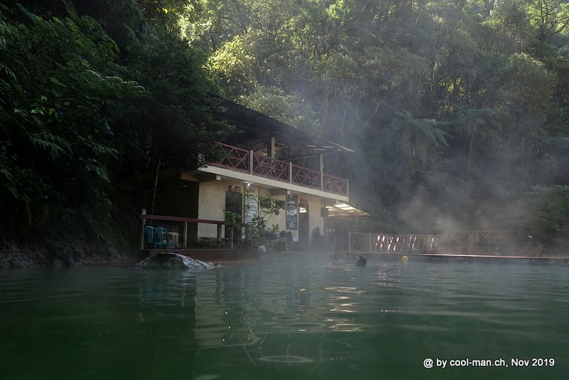
Fuentes Georginas
One of the sights was the Fuentes Georginas, hot springs with various pools surrounded by impressive tropical vegetation. They are about 20 km away from Xela and could only be visited on a tour without a vehicle of your own, as there is no bus to the springs. We enjoyed a few hours in the pleasantly hot water, surrounded by the special vegetation adapted to this micro climate.
We enjoyed a few pleasant hours in the warm water of Fuentes Georgina’s springs.
Salcaja
In the afternoon we visited by bus the small town of Salcaja, which is 10 km away from Xela and according to the tourist information office is worth seeing. Well, we found a noisy, dusty little town. Here you can find the oldest church in South America, built in 1524, called ‘Ermita de Concepción La Conquistadora’.
The 1524 built church with the name ‘Ermita de Concepción La Conquistadora’ is the oldest in South America.

In the new church of the small town of Salcaja

San Andres
With another bus we continued to the higher located and already more worthwhile to visit San Andres, that is known for its church ‘Iglesia San Andrés Xecul’. On the yellow facade there are angels, saints, flowers, tigers, monkeys and climbing plants in different colors.
The unique church ‘Iglesia San Andrés Xecul’

That evening one of the many local festivals took place. In front of the church, chairs were already set up and a choir sang church songs.

Just before sunset we took the last bus back to Xela.
The next day the ascent of the volcano Santa María (3’772 m) was scheduled. As the ascent was too strenuous for my travel partner, she booked a tour to Volcán Santiaguito (2’488 m). In the morning I was at 6 o’clock at the agreed meeting point. It was cold and the twilight slowly set in. I was alone there and stayed alone. Actually I should have been picked up by a bus and paid the driver at this time. At 7 am I was back at the hotel where the reception knew the phone number of the travel agency owner. Drunk asleep he answered the phone. “I am sorry” was all I heard from Adrenalina Tours. I was very disappointed, because the next day my travel partner wanted to travel further and therefore an ascent was not possible anymore. It was already too late for this or another hike on the same day, so that I started the day calmly and from time to time had a look at the cloudless volcano Santa María. It would have been the ideal day for climbing the volcano.
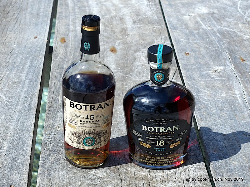
Distillery Casa Botran
When I learned that there was a rum distillery near Xela, it was clear that I wanted to pay it a visit. Actually, all the tours were fully booked that week, but when I called the distillery and explained how I would love to visit the distillery, the lady was willing to give us an additional tour and tasting. This distillery produces the rum directly from the sugar cane, which gives a more aromatic rum than the rum made from molasses, such as that produced by the Distillery Travellers in Belize. Unfortunately we were not allowed to take pictures inside the distillery. All the more we got our money’s worth during the tasting. I liked the 15 anos reserve according to Sistema Solera best. With this rum the rum flavors were shown to their best advantage. The Sistema Solera 18 anos was even more balanced, so that the typical rum notes were less prominent. Both rums were excellent, so that I bought one bottle each and had a sip from time to time on the further journey. The Sistema Solera means that the rum is mixed with younger rum over the years in order to ensure a consistent quality.

The tasting was well organized. The Sistema Solera 18 anos rum was served later.

The two rums Sistema Solera 15 anos and Sistema Solera 18 anos are both excellent spirits.
Afterwards we wanted to visit Laguna Chicabal, 20 km away, which is a sacred crater lake for the Maya’s in the volcano Chicabal. Around noon it was already too late to visit the lake, as fog usually comes up in the afternoon. Furthermore we would have been alone there at this time, which was a security risk.
Unfortunately there was no direct bus connection from Quetzaltenango to Rio Dulce, our next destination, 460 km away. The tourist van option would have included a private transfer to a transfer point, so the trip would have cost USD 60. This seemed like a lot for a country like Guatemala. So we decided to take a regular big bus to Guatemala City, stay there two nights, explore the city and then take another regular but comfortable big bus to Rio Dulce.
Guatemala City
Actually Guatemala City was not part of our planned route. It seemed too dangerous in relation to the limited number of sights. As in any big city there are safer and less safe areas in Guatemala City. Zone 10 was classified as safe, so we booked our hotel there. It turned out that in this zone was the modern Guatemala City, with hotels like Hilton or Holiday Inn. During the night we even walked to nearby restaurants without getting hurt. We used Uber as a means of transport in the city. On the one hand it was safest because of the drivers’ ratings, but on the other hand it was also very cheap.
As the restaurant Flor de Lis was closed the following evening, I visited the restaurant recommended by other travelers on Tripadvisor as it most resembled a gourmet restaurant on the first evening. Despite of some good approaches, it could not meet my expectations.
Surprisingly, the two most important museums ‘Museo Ixchel del Traje Indigena’ and ‘Museo Popol Vuh’ were closed on Sunday, so that we had to renounce the visit. Both museums document the diversity of the indigenous handicraft.
The church ‘Iglesia Nuestra Señora De La Merced’ is the most impressive colonial church in Guatemala. Its construction began in 1548, and the church was enlarged and decorated again and again until an earthquake destroyed it in 1717. Only a few years after reconstruction, the church was destroyed again by an earthquake and then rebuilt. There are many statues of saints in the church, so that the faithful always find a patron saint whom they can worship with devotion and ask for help.
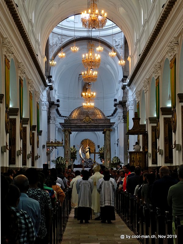
The ‘Catedral Metropolitana del Apóstol Santiago de Guatemala’ is located directly at the Parque Central, the main square of the city. This church was also repeatedly destroyed by earthquakes. During our visit the mass just started, so that we could watch the entry of the many clergymen.
In the church ‘Catedral Metropolitana del Apóstol Santiago de Guatemala’ we could watch the entry of the clergy at the beginning of a mass.
Nearby was the pedestrian zone with countless shops, which were very popular with the locals on this Sunday.
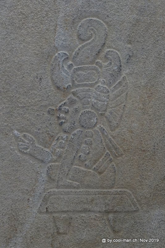
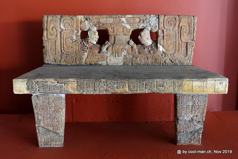
The ‘Nacional Museo Nacional de Arqueología y Etnología’ showed Mayan objects like statues, grave steles, jade art and ceramics. It also introduced us to the culture of the different indigenous peoples of Guatemala.

The next day we traveled with by overland bus to Rio Dulce, 280 km away.
Rio Dulce
The small town of Rio Dulce is located on the lake Lago de Izabal. We stayed in a bungalow a few minutes by boat from the town directly at the river. The property also included a fully occupied marina, as Rio Dulce is considered a safe anchorage during the hurricane season from June to December.
Castello San Felipe
The next day I took a 3 km walk from Rio Dulce to the fortress of ‘Castello San Felipe’, strategically located on a headland from where the boat traffic on the river Rio Dulce could be controlled. In the course of time the fortress decayed. Today a reconstruction built in 1956 can be admired.
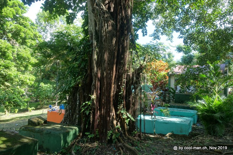
The typical colored graves on the way to the fortress ‘Castello San Felipe’
The reconstructed fortress ‘Castello San Felipe’

Livingston
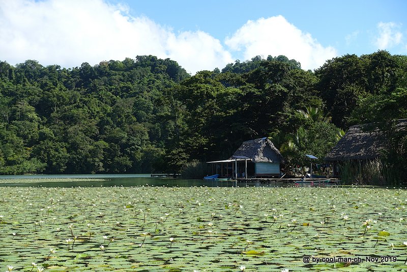
Every visitor to Rio Dulce takes a river cruise down the Rio Dulce River through the Rio Dulce National Park to the Caribbean coast. The journey takes you through mangroves, past overgrown riverbanks, across a lake with a stop at hot springs to Livingston.
On the river journey from Rio Dulce to Livingston
On the way, women sell their homemade goods to tourists from small boats.

Arrived at this run-down coastal town, one feels like in another country. The people are black, the women are fat and reggae sounds from the loudspeakers. The Garifuna people are mostly descendants of mutinous black slaves from the Caribbean island of St. Vincent, who over time mixed with other Caribbean, Mayan and mutinous sailors and developed their own diverse culture and language. We were lucky to be in Livingston on the national holiday of the Garifunas on November 26. A parade went through the city, improvised stalls offered food and drinks, loud music was played everywhere and there was a general exuberant atmosphere.


Another highlight of Guatemala is the area around Semuc Champey. Here you will find numerous basins through which the river Rio Cahabon flows and which invite you to take a bath. The journey from Rio Dulce seemed to be complicated with some transfer stops. Only when we bought the ticket to Flores we noticed that a direct tourist van would have gone to Semuc Champey. We could have guessed it.
Flores
The small city Flores comprises a whole island of a few hundred meters length in the lake Lago de Petén Itza that is connected to the mainland by a 500 m long dam. Due to the small size of the island, many of the good restaurants and hotels offer lake views. It is a picturesque little town with cobblestone streets and narrow alleys.
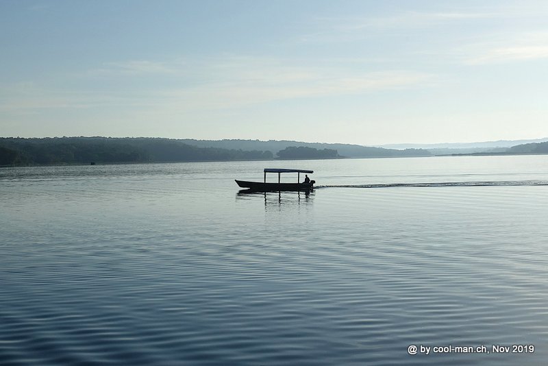
On the lake ‘Lago de Petén Itza’, where Flores forms an island
Flores itself offers hardly any sights. But it is the starting point for visiting Tikal, the most impressive ancient Mayan city in Guatemala.
Tikal
I had read in the travel guide and on websites that a ticket for Tikal is valid from four o’clock in the afternoon of the previous day, so that one can already experience the sunset in this historical site before exploring the whole complex the next day. This is why we decided to stay over night in a more expensive hotel right at the park. When we arrived at the entrance of the park and wanted to buy our tickets, we were told that the rules already changed three years ago and now, the entrance fee has to be paid for each day individually. Furthermore we should have bought an additional ticket for an entrance at sunset, as outside the official opening hours a guide is mandatory. Since we did not expect sunset because of the clouds, this was not an option. As the park entrance and our hotel was located in the middle of the jungle, the hotel had no electricity and no internet during the day. Only in the evening the generator was turned on and via satellite there was a very slow internet access.
The next morning at six o’clock the park opened its gates and the few visitors quickly spread around the area. First we visited lesser known temples, so that we were on our own from the beginning. The Mayas inhabited this area from 700 B.C. Soon they started to build religious stone buildings. The inhabitants of Tikal were successful warriors and extended their sphere of power more and more. In the 6th century AD, Tikal had over 100’000 inhabitants on an area of 30 km2. Around 900 AD the city was abandoned for unknown reasons, but the city was not forgotten, as records of Spanish missionaries show. From the 19th century onwards, various archaeologists examined the site. The temples and squares were excavated, partially restored and cleared of trees and climbing plants. In 1979 the national park became a UNESCO World Heritage Site.
Tikal differs from the other Mayan sites because it is the only one in the middle of the jungle today. In addition, the shape of the steep-walled pyramids, some of which are over 60 metres high, is unique. The hike from one temple to another led through dense vegetation. You could hear birds and the loud rutting cry of the howler monkeys. We could even watch these monkeys hanging from tree to tree.
Unfortunately the weather was cloudy and foggy early in the morning. On the one hand we experienced a mystical atmosphere, but the photos were not convincing.
The 47 meter high temple I early in the morning. It was built between 682 and 734 AD.

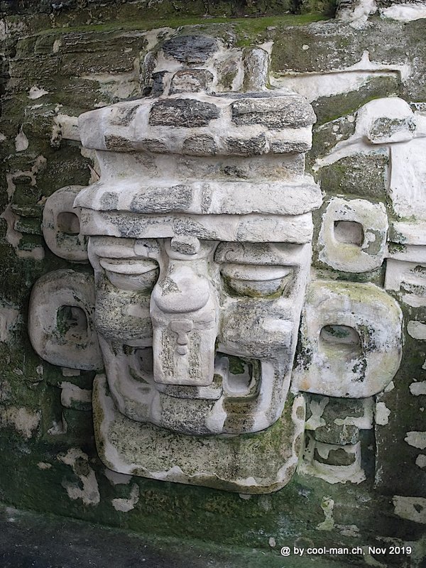
This is one of two masks that can be found on each side of the stairways of Temple II, also called Temple of the Masks (Templo Del Mascaras).
Only towards the end of our Tikal exploration the sun was shining. My travel partner just wanted to go back, but I was still able to take some great pictures.
In the foreground the ‘Grand Temple’ of the ‘Mundo Perdido’ complex.
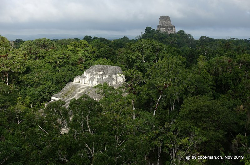
The view from Temple IV, 57 meters high, to Temples I, II and III.

On the way to the exit we passed Temple I again. The photos just get better with sunshine.

After another day in Flores we continued our journey to Belize.
Guatemala offered few extraordinary sights, but it was expensive for tourists in relation to the living standard of the population. This was probably because every business has to pay protection money, which is passed on to the consumers. As most of Guatemala is situated at an altitude of over 1,500 m, it was cool in the evening and at night. In addition, the sun often shone only in the morning and clouds came up in the afternoon. To travel independently was mostly complicated and partly not indicated because of the security situation, so we often traveled in tourist buses and took part in overpriced tourist tours, which I actually want to avoid if possible.
This text is an automatic English translation from the German original by deepl.com