November / December 2020
From November it became cold and foggy in Switzerland, so I started looking for warmer places. Because of the many restrictions, it was not easy to find a suitable destination. I looked more closely at the Red Sea in Egypt, but at this time of year it is windy there and cool in the evenings. Then a call from an acquaintance came just at the right time. He had already been to the Canary Islands several times and now wanted to visit the less visited islands of La Palma and La Gomera. Both islands are hikers’ paradises.
I was lucky and entered four days before the PCR test was mandatory. After a few days on Tenerife, I met my acquaintance on the island of La Palma.
Table of Contents
La Palma
Puerto Naos
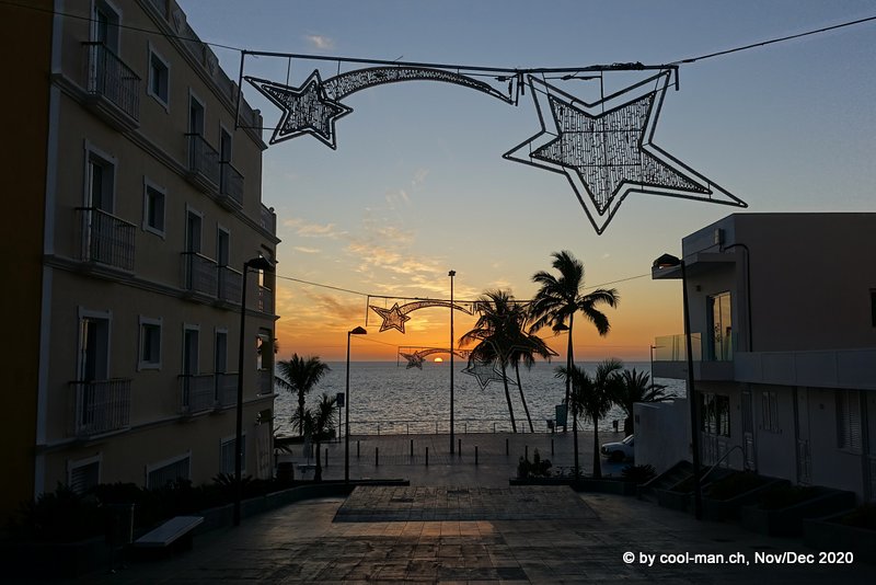
Thanks to the Corona pandemic, we were able to rent an apartment right on the beach in the small village of Puerto Naos at short notice. The place was the ideal starting point to reach almost all places of the island with our rental car.
The beach of Puerto Naos

Sunset, seen from our apartment
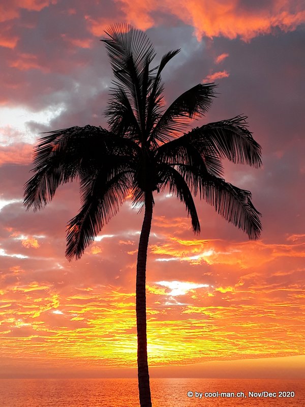
Puerto Naos sunset
El Time Viewpoint
From the village of Puerto de Tazacorte we hiked to the viewpoint El Time, which offers a wide view over the coast …
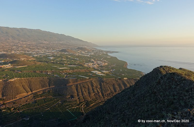
… and to the town of Los Llanos. The large white areas are banana plantations covered with tarpaulins.
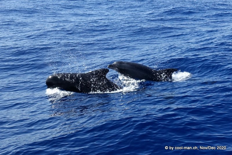
Whale tour from Puerto de Tazacorte
After a long search, our boat discovered a group of pilot whales and dolphins that stay off La Palma all year round.
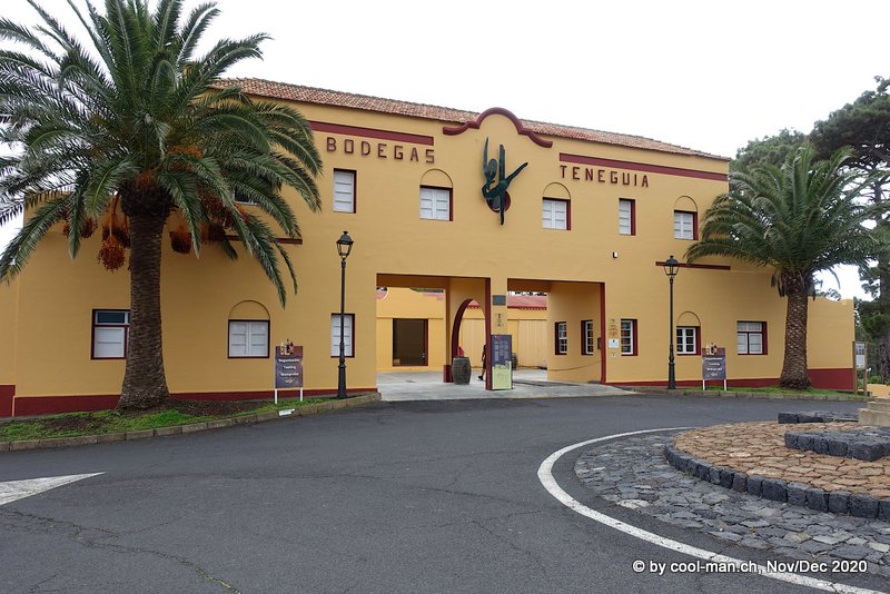
Bodegas Teneguía
On a cloudy day we visited the Bodeaga Teneguia. The tour was very casual and unconventional. We tasted a first wine on the crater rim of a nearby volcano. We learned that due to the increasing dryness in the area, wine production has halved in recent years.
I was able to buy the last available bottle of the excellent sweet wine.

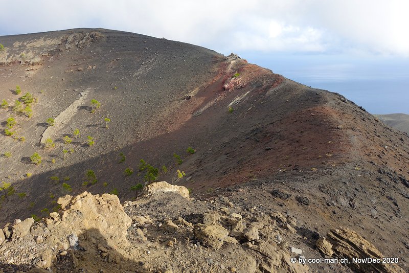
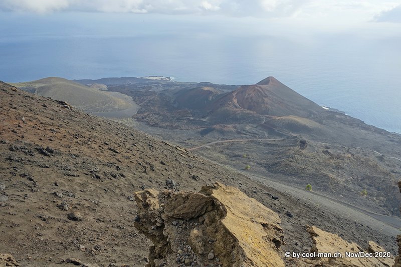
Hike from Los Canarios to the lighthouse of Fuencalientes
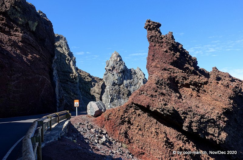
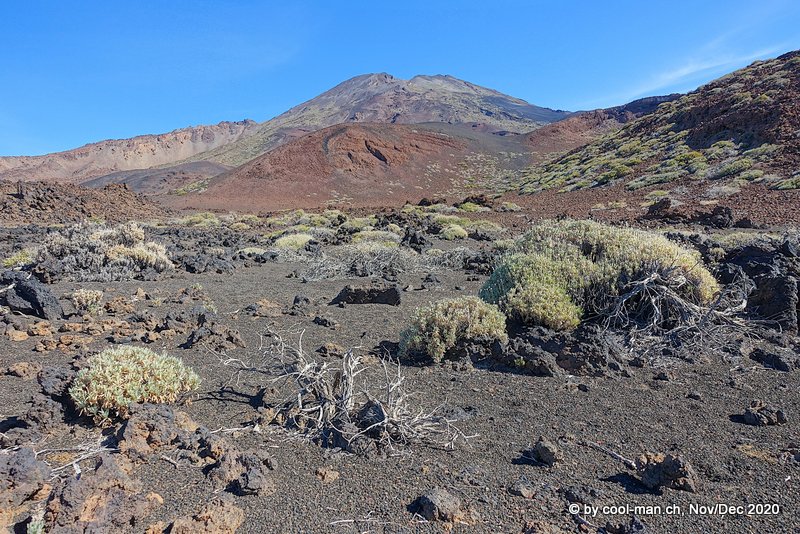
On another day we made an impressive hike to the southernmost tip of La Palma. From Los Canarios we went downhill past the volcano San Antonio over lava fields from the last eruption in 1971 to the lighthouse of Fuencalientes.
Around Roque de los Muchachos
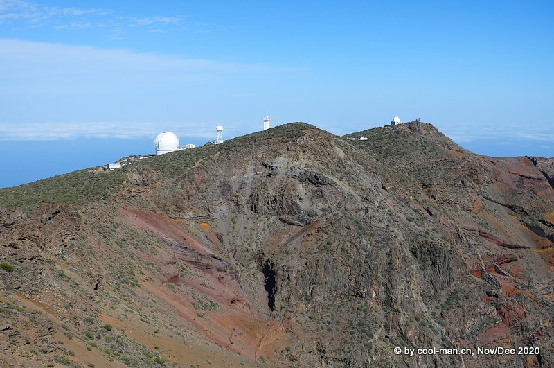
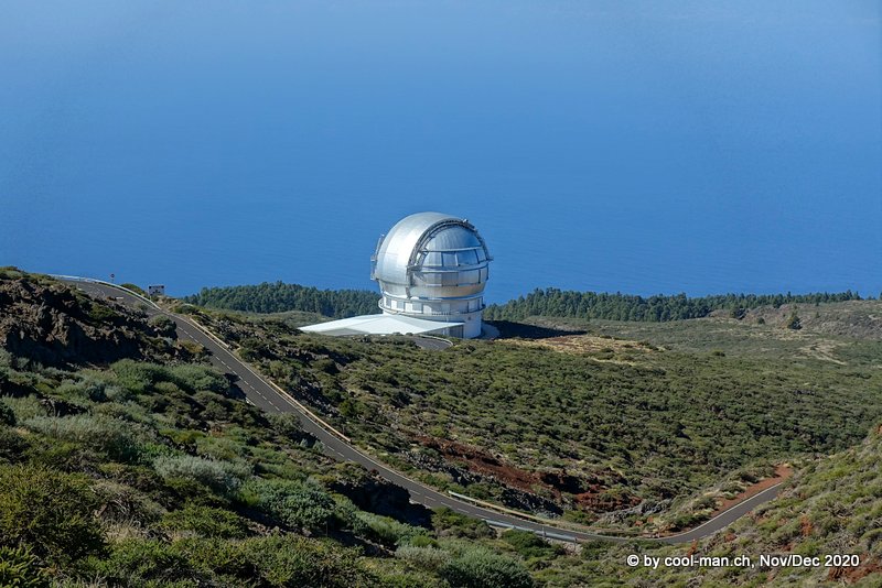
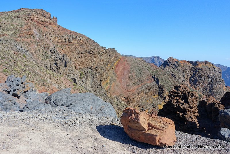
After almost 2 hours of driving we reached the highest point of the island at 2’423 meters above sea level, the Roque de los Muchachos. The whole area is part of the crater rim of a huge ancient volcano.
Some of the largest observatories in the northern hemisphere are located here, due to the altitude and the very dry air.
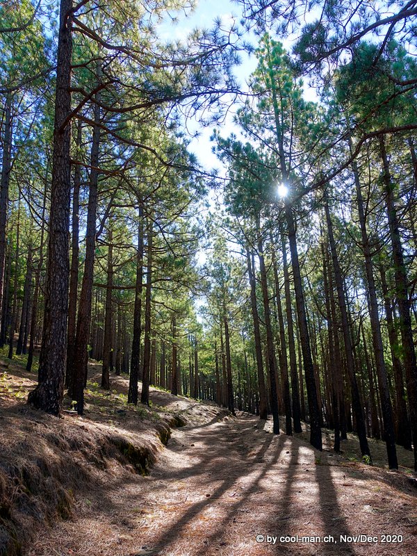
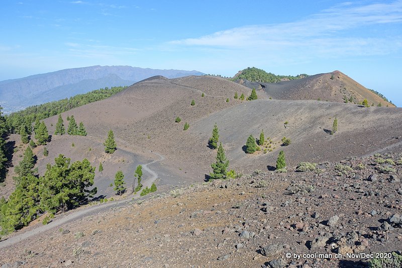
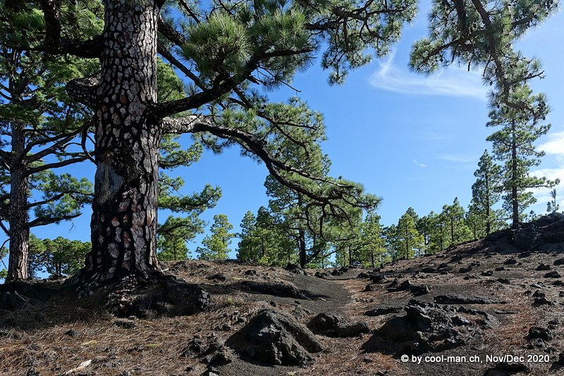
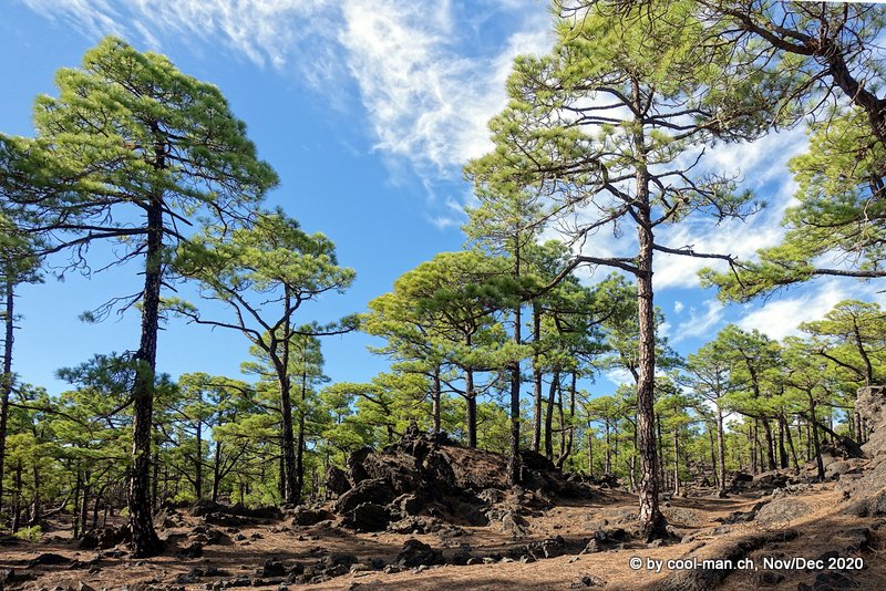
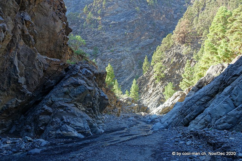
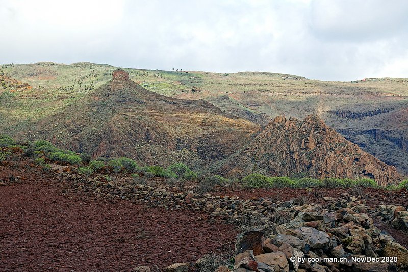
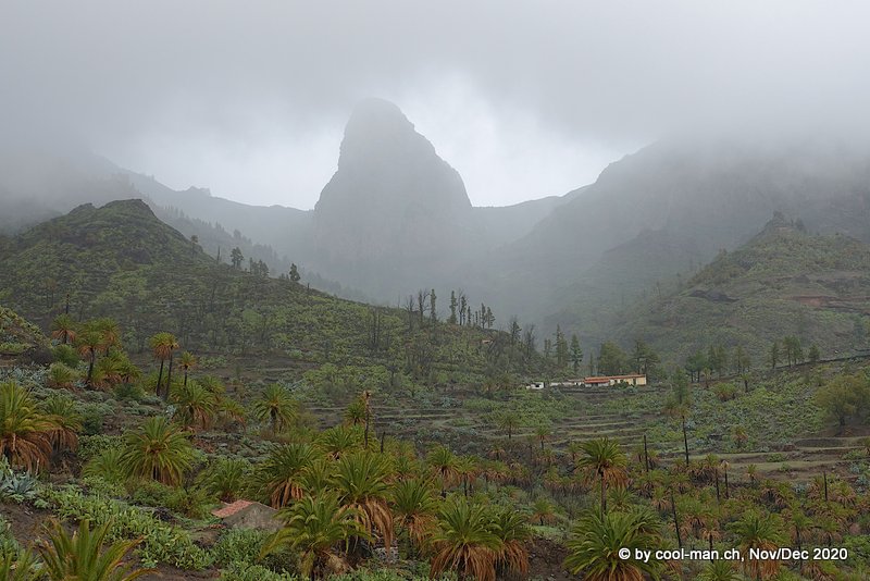
Hike from Refugio El Pinar to Los Canarios – The Volcano Route (Ruta de los Volcanos)
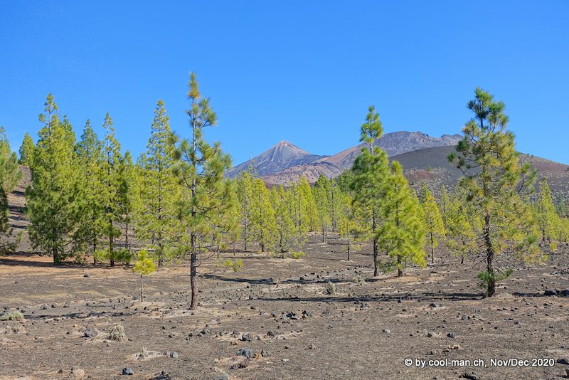
A highlight of our stay on La Palma was the 17 km hike from Refugio El Pinar to Los Canarios. The route runs from the center of the island south across the area of the old volcano Cumbre Vieja, which is dotted with several new volcanic cones of varying ages.
We parked the car at the visitor center of the National Park “Caldera de Taburiente” and took a cab to the Refugio El Pinar.
After starting at Refugio El Pinar, the sun was shining through the pine forest.
A volcanic cone with solidified lava

Fantastic landscapes

A bus brought us back to our car at the visitor center of the National Park “Caldera de Taburiente”.
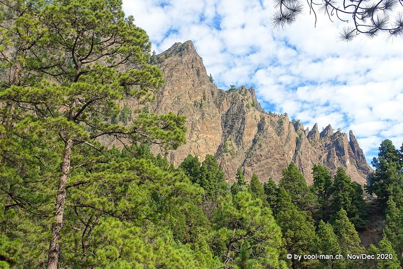
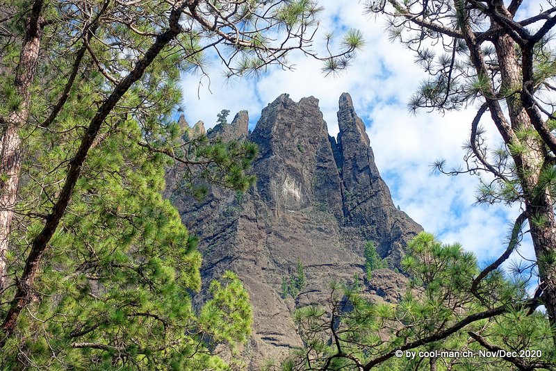
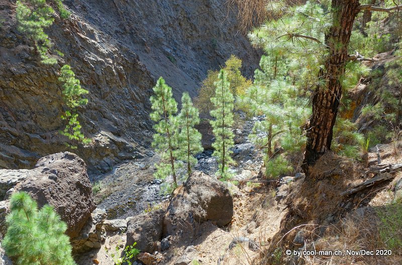
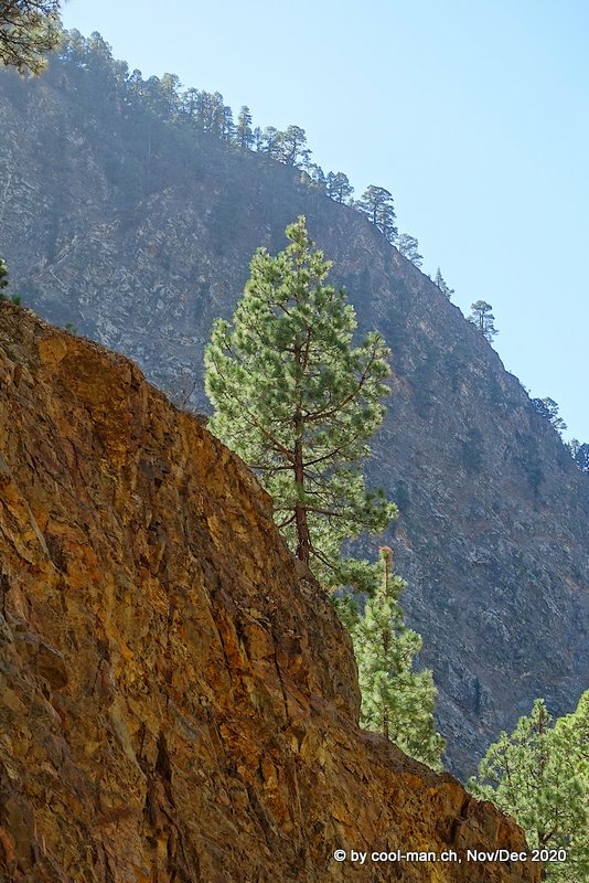
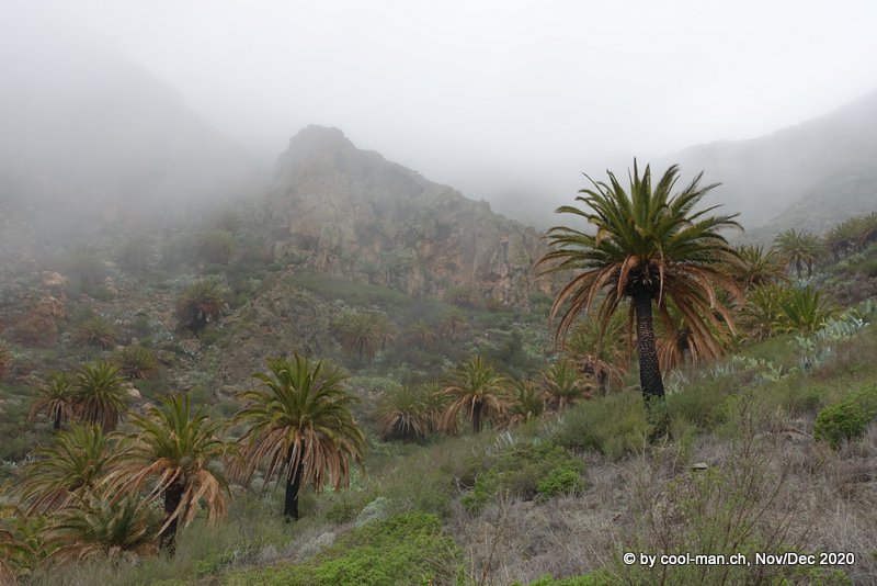
Hike from Los Brecitos through the crater Taburiente
For this hike we parked our car at the creek bed of Barranco de las Angustias. An expensive cab took us in half an hour to the viewpoint Los Brecitos, where we started our hike through the crater. The path led in an arc along the huge crater back to the car.
The hike was a breathtaking experience, as the photos show.

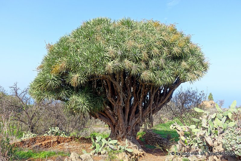
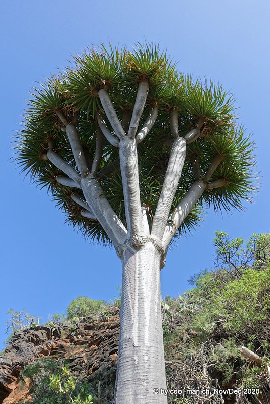
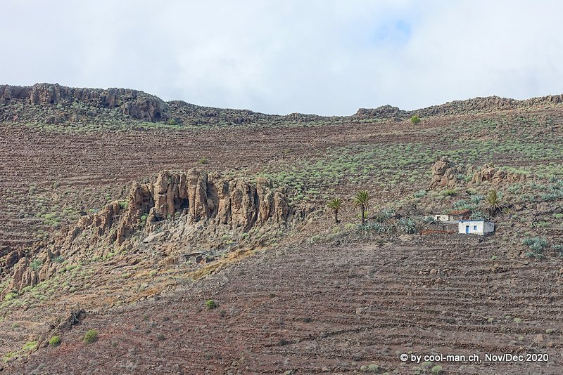
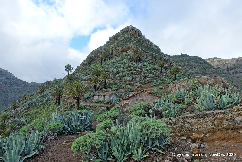
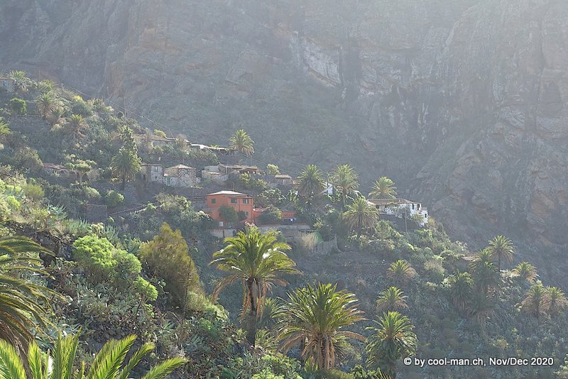
Hike around Las Tricias
The village of Las Tricias, located in the northwestern part of the island, was the starting point of a half-day hike where we saw dragon trees.
Dragon trees
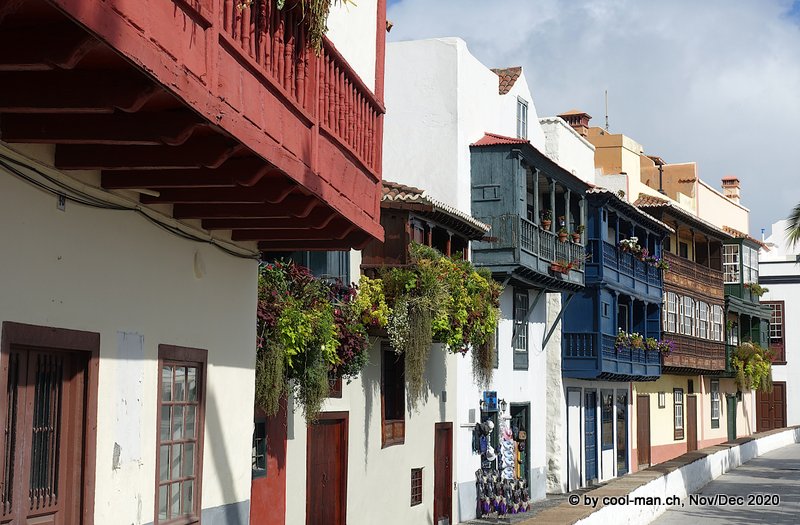
The island capital Santa Cruz de la Palma
The last two days we stayed in the island capital, where we marveled at the best preserved Canarian wooden balconies.
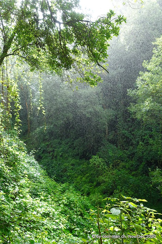
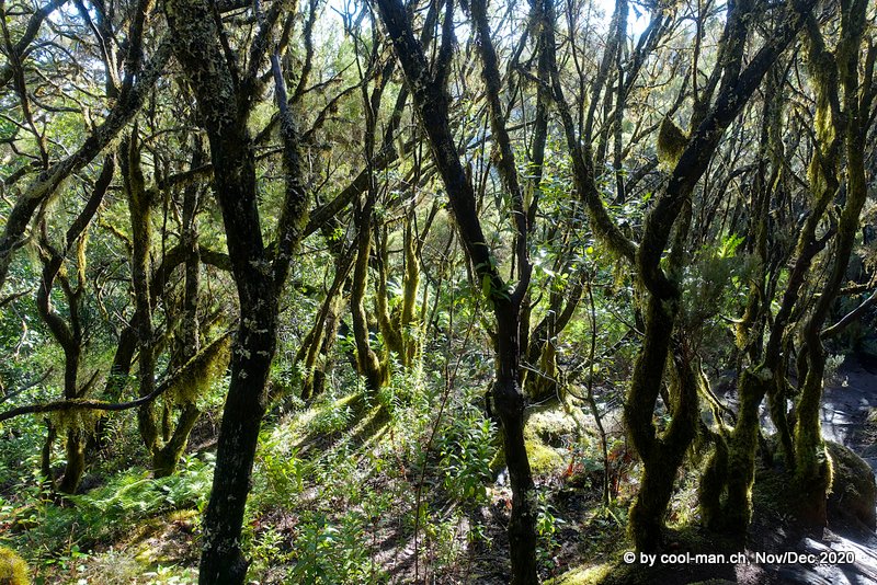
Hike from La Galga to Mirador de Somada Alta
From Santa Cruz de la Palma we discovered the rainy and green northeastern part of the island on this hike through a species-rich forest.
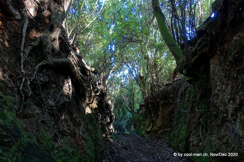
As usual for this area, rain occurred and drenched us.
La Palma is a diverse island and as the photos show definitely worth a visit.
La Gomera
On our travel day to La Gomera we had to get up early, because the ferry left La Palma at 4 o’clock in the morning.
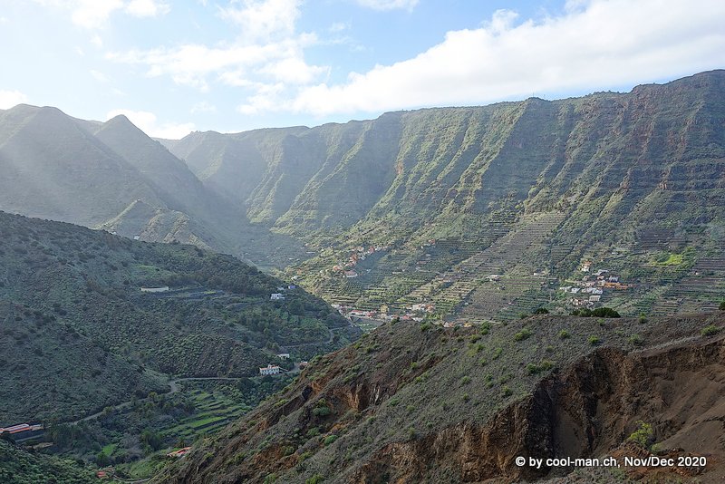
La Gomera is mountainous with steep slopes and deep gorges. Although the island is quite small with a diameter of 22 km, the highest mountain Alto de Garajonay rises to 1’487 meters. The upper part of the island is usually shrouded in fog and clouds, allowing a unique laurel rainforest to develop here, forming the Garajonay National Park. In 1986 it was declared a UNESCO World Heritage Site.
On La Gomera we did without a rental car, since most of the hikes led from one place to another and, despite the thin bus schedule, we always found a suitable bus connection with one exception, thanks to good planning. Once we were surprised by a downpour and therefore called a cab, but later there would have been another bus.
The tourism authority of La Gomera drew our attention to the very useful app “Info La Gomera”. In addition to the bus information, all hikes were also marked on the map. Thanks to the location via GPS, we always knew if we were on the right path, which made hiking much easier. Over 70 hikes of varying length and difficulty were signposted and supported by the app.
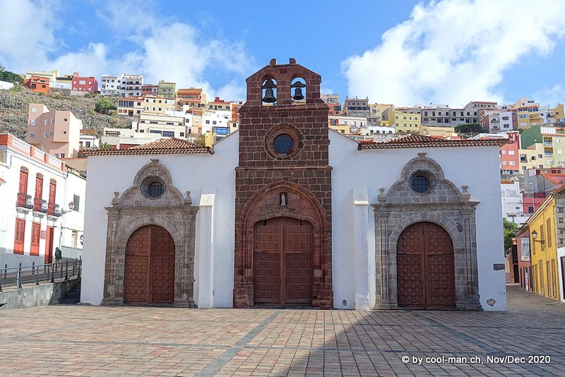
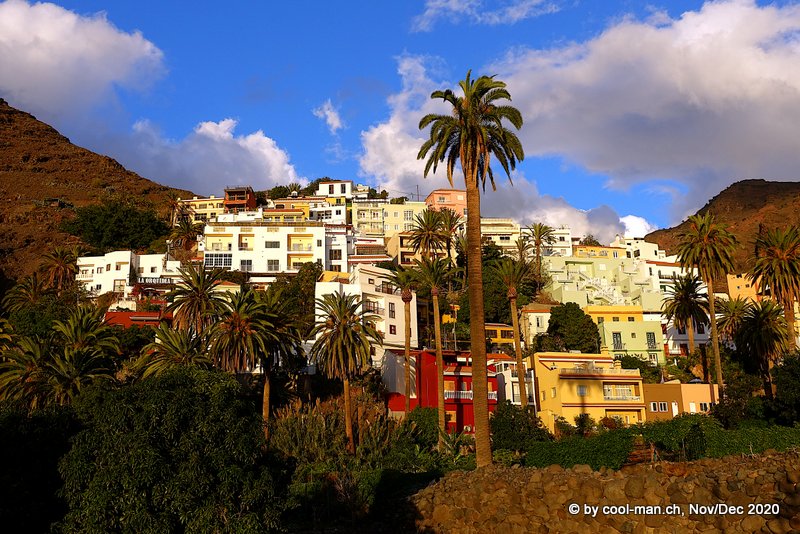
San Sebastian de La Gomera
The church of the island capital San Sebastian de La Gomera
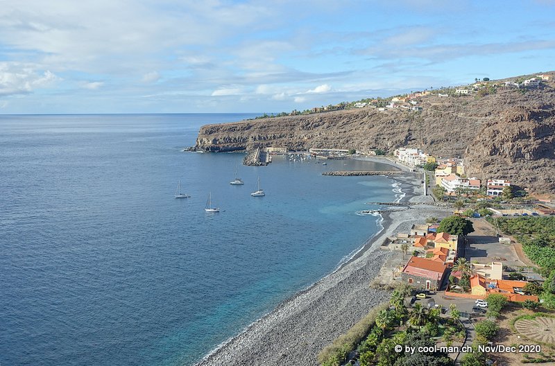
Hike from Playa de Santiago to the Degollada de Peraza viewpoint
At 8 o’clock in the morning, the bus left San Sebastian for the airport and took us to Playa de Santiago.
The small coastal town of Playa de Santiago has the sunniest microclimate on the island.
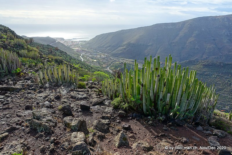
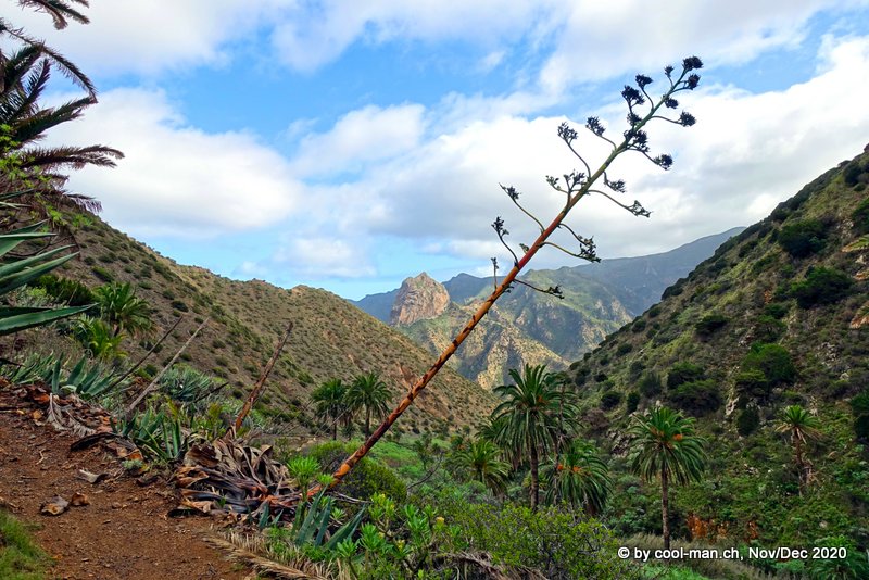
Actually, we wanted to do the 20 km long coastal hike No. 27 from Playa de Santiago to San Sebastian. But hiking along the coast was rather monotonous. At the deserted village of Morales I saw inland this interesting landscape, so we decided to change our route and take the steep path to Degollada de Peraza, a viewpoint in the mountainous center of the island.
At the abandoned village of Morales, I saw this impressive landscape that moved us to hike to the viewpoint Degollada de Peraza.
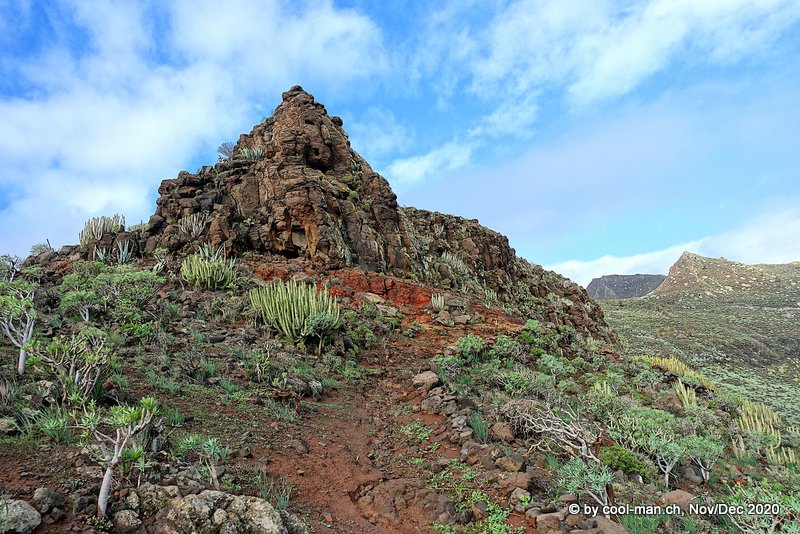
We encountered palm trees and cacti in a wild landscape again and again on La Gomera.
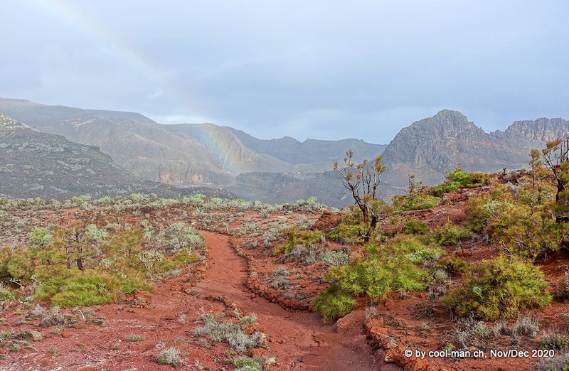
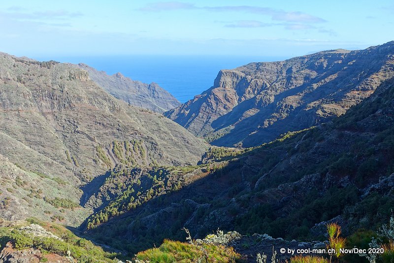
Hike from San Sebastian to Hermigua
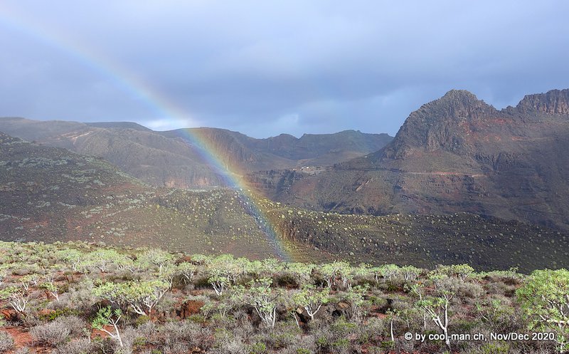
The following day we hiked 26.9 km from our apartment in San Sebastian to the mountain village of Hermigua. Shortly before we left, it was raining lightly. When the sun showed up briefly, we were able to marvel at a rainbow. A magical moment!
A look back to San Sebastian, which lies at the end of the valley by the sea.
Before arriving, we looked out over the valley of Hermigua, whose slopes are terraced all the way high up to allow agriculture on the steep land.
Valle Gran Rey
After we had done all the interesting hikes from San Sebastian, we traveled on by bus to Valle Gran Rey, a pleasant little town with a black sand beach. Since the bus left from here every day at 8 a.m. to the mountainous interior of the island, Valle Gran Rey was the ideal starting point for our excursions. We stayed for more than a week in an apartment with a wonderful view over the village and the sea.
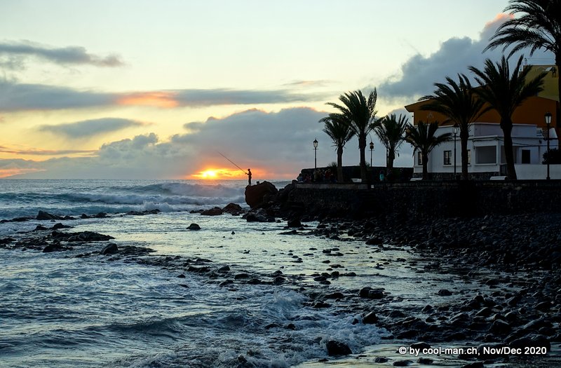
Sunset atmosphere in Valle Gran Rey
Sunset with a fisherman
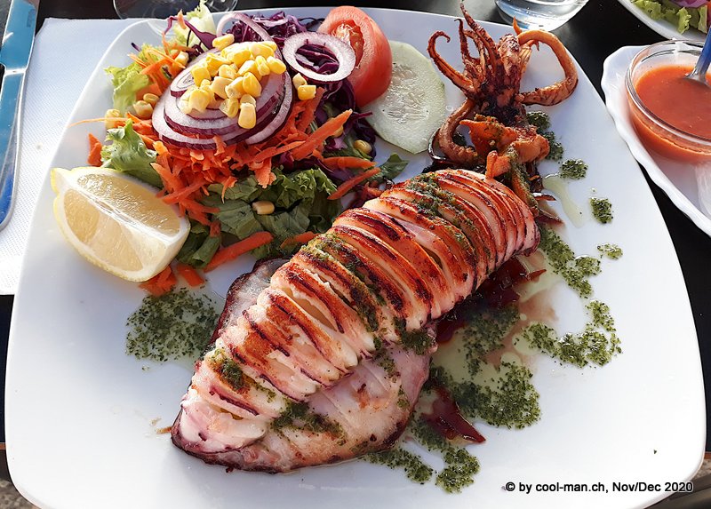
I love all kinds of seafood: A grilled squid
Hike from Pajarito to Imada and via Benchijigua to Playa Santiago
An expat German raved about the landscapes around Imada and Benchijigua, so we decided to hike from the Pajarito bus stop in the mountainous interior to these two places and then down the valley to Playa de Santiago. This was also a long walk, over 20 km.
The landscapes were impressive. Unfortunately, the weather was bad. It was raining at times.
The shreds of clouds created a unique atmosphere.
Hiking Trail No. 18 in Garajonay National Park
The tourist information raved about this loop hike in Garajonay National Park. If we were going to do only one hike, this would be it. Although it is “only” 16.1 km long, the hiking time was listed as 9 hrs. 10 minutes. Moreover, it had the highest degree of difficulty. Therefore, we expected a challenging hike through difficult terrain.
Since the rainforest was shrouded in humid fog most of the time, we waited several days for the perfect day. Then the time had come.
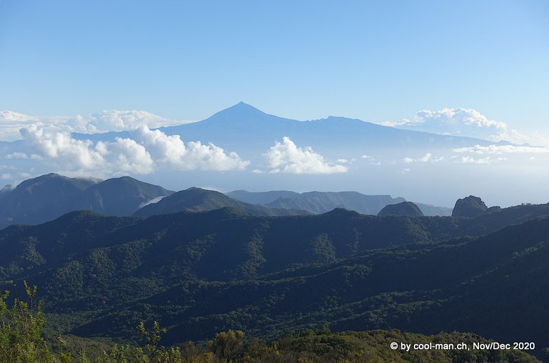
At 8 a.m., the bus left Valle Gran Rey for the Pajarito bus stop in the mountainous interior of the island. First we hiked up to the highest mountain of La Gomera, the 1’487 meter high Alto de Garajonay. From here we could admire the volcano Teide on Tenerife, which I climbed later.
From the highest mountain on La Gomera, the 1’487 meter high Alto de Garajonay, I could see the volcano Teide on Tenerife, the highest mountain in Spain with 3’715 meters.
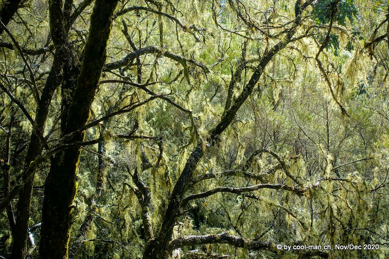
Our hike took us through the laurel rainforest of Garajonay National Park. In 1986, the park was declared a UNESCO World Heritage Site. Thanks to the high humidity, the trees are covered with lichen. An impressive hike on which I stopped again and again and took countless photos.
The path through the forest was wide. We were curious when the path would become more difficult, but the whole hike had no challenging parts. We had already done most of the hike when we came to the Contadero viewpoint. Fog was already rolling in and before I had the camera ready, the imposing rock formation in front of us disappeared behind the clouds and heavy rain began to fall, never ending. Soaked, we made our way back to Pajarito, the starting point of our hike. We were freezing and didn’t want to wait for the bus, which didn’t leave for another two hours, so we ordered a cab to take us back to our apartment in Valle Gran Rey for €40. Although I took plenty of time to take pictures in the forest, we completed the hike in about 5 hours. If we hadn’t followed the trail on the La Gomera app, we probably would have assumed we had taken a wrong route, because the stated duration of 9:10 hrs and the difficulty level were not correct at all.
Hike from Epina to Vallehermoso
The next day we took the bus at 8 o’clock in the morning to the village of Epina, where we started our hike to Vallehermoso. Unfortunately, it was mostly cloudy that day as well.
The first part led along the northwest slope of the island amidst countless palm trees to the chapel Ermita Santa Clara. We could see the volcano Teide of the neighboring island Tenerife on the horizon.
The descent to Vallehermoso led through the fertile valley Barranco Era Nueva. A wonderful landscape and a great variety of plants awaited us.
Shortly after our arrival in Vallehermoso, rain set in and the fog shrouded the spectacular landscape of deep valleys and rock formations. After a meal in one of the few open restaurants, we took the bus back to Valle Gran Rey.
Unfortunately, the weather forecast kept predicting rain for the foreseeable future, so we decided to leave earlier than planned for Tenerife, the last island on our trip.
Tenerife
Tenerife is the largest and most populous island of the eight Canary Islands and the largest island in Spain. In addition, the volcano Teide is the highest mountain in Spain at 3,715 meters above sea level. Although many tourists visit the island, the interior offers great landscapes without tourist crowds.
We stayed in a centrally located apartment in the tourist town of Los Cristianos and rented a car, which gave us more flexibility than public transportation.
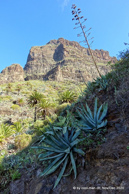
Hike from Vilaflor to Paisaje Lunar
To run in, we went on a 13 km hike from the mountain village of Vilaflor through pine forests to Paisaje Lunar, an area with peculiar rock formations.
On the way to Paisaje Lunar
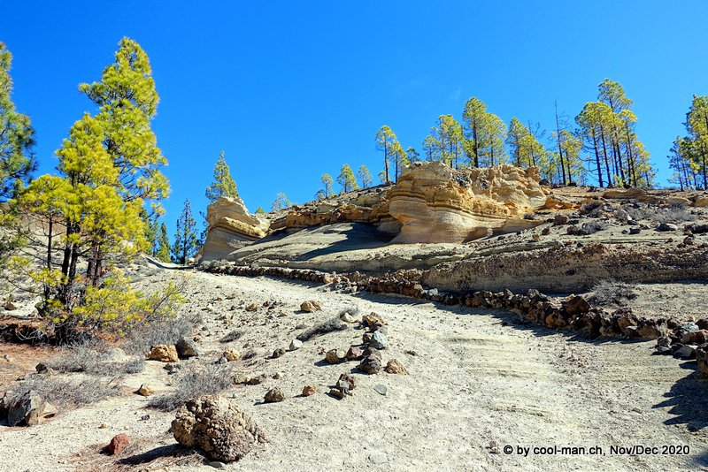
At the destination of our hike, the Paisaje Lunar, fog came up, so that the rock formations did not seem very impressive. Moreover, we could only view them from a distance. But as the photo above shows, the trail itself was more rewarding than the Paisaje Lunar.
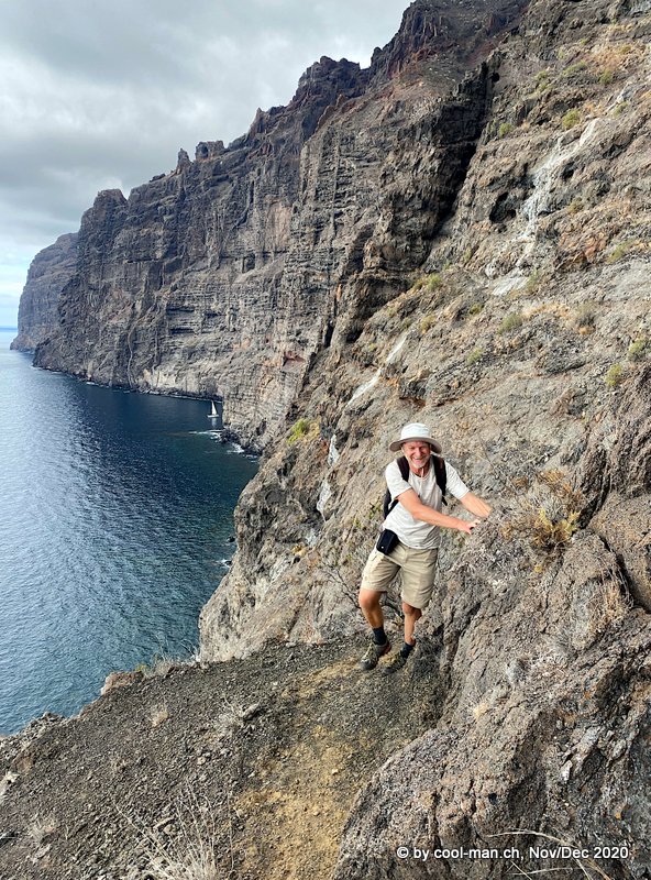
Hike from Tamaino to Los Gigantes through two tunnels
This adventurous hiking trail is officially closed, because the path along the cliffs of Los Gigantes is not without danger. After reaching the village of Tamaino by bus, we soon found the unlocked gate to the first 1.2 km long tunnel, built in the 19th century to bring water from the mountains to the villages. At the end of the tunnel we had reached the wild valley Barranco Seco, where an initially hidden path led down. Further down the valley we crossed the second tunnel, also 1.2 km long. Back in daylight, we found ourselves 220 meters above sea level in the Los Gigantes cliffs. We enjoyed the great view of the cliffs, the sea and our destination, the town of Los Gigantes. A partly difficult to find path led us along the cliff high above the sea. A wrong step or a stumble meant certain death here. With respect for the danger and looking at the path instead of down at the sea, we arrived safely in Los Gigantes.
Casa del Vino and Bodegas Monje
On a rainy day we visited the wine museum of the island. We learned about the many grape varieties, the different ways of cultivating the vines depending on the origin of the settlers, the cycle of the vine throughout the year, the historical markets and the history of wine on the island.
The history of wine in Tenerife was particularly interesting. Already in the second half of the 15th century, Spanish and Portuguese immigrants brought vines to the island. Later, French and Italians brought other varieties. The vines thrived magnificently on the volcanic soil and an ideal climate. Especially the wine from the Malmsey grape was an export hit, so that winegrowing soon constituted an important part of the economy. London and Antwerp in particular were important export markets. Increasingly, ships bound for South and North America were also loaded with wine in Tenerife, as wine was not yet available in the American colonies. Wine soon replaced sugar cane as the main export. The supremacy of wine exports was to last for more than 300 years. Canary Malmsey wine was a coveted luxury good. Even William Shakespeare received a barrel of this wine every year as part of his salary.
We then visited the nearby Monje Winery, where we had to wait until a TUI tourist group left the winery. I liked the wine from the island of La Palma better, as the wines from Tenerife tasted too sulfurous for my taste because of the volcanic soil.
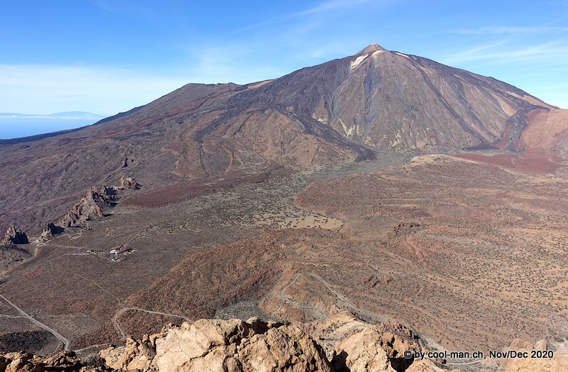
Hiking around the Roques de García and on the Alto de Guajara
The next day we climbed the mountain Alto de Guajara in the Teide National Park in the middle of the island. Starting point was the lodge Parador de Cañadas del Teide. Right at the Parador the rock formations of Roques de García attracted us, around which a hiking trail led.
One of the rocks of Roques de García
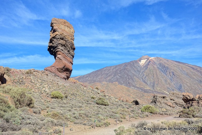
In two hours we reached the summit of the 2’781 meters high mountain Alto de Guajara. We enjoyed the fantastic view of the Teide volcano and, on the left, the rock formations of Roques de García and the lodge Parador de Cañadas del Teide. The different colors testify to the different chemical composition of the lava from different volcanic eruptions.
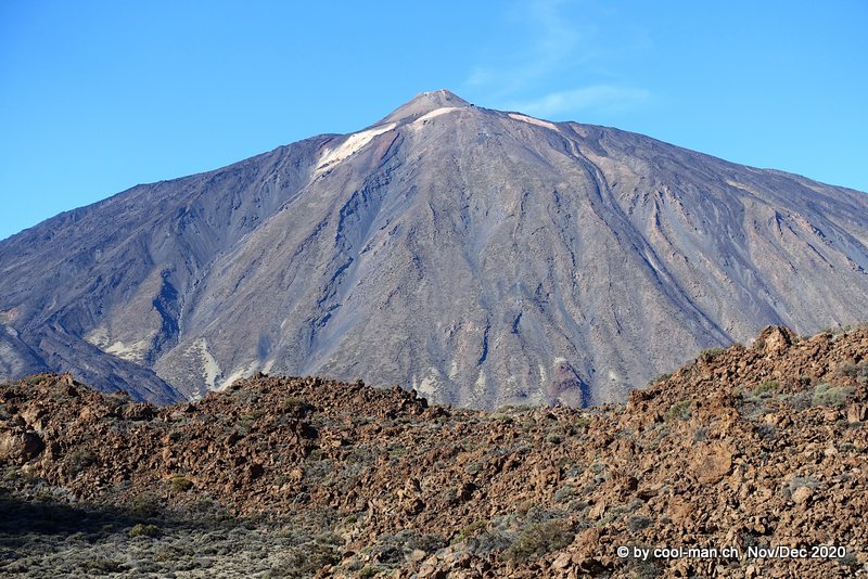
On the descent at the edge of a lava field with the volcano Teide in the background
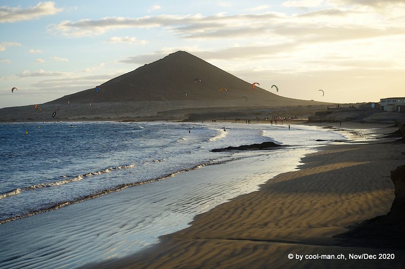
El Médano
We spent the next day at the beach town El Médano, which is famous for kite- and windsurfing. We can see the hill Montaña Roja in the background.
My colleague wanted to go to the Canary Island of Gran Canaria after Tenerife. He decided at short notice to bring forward the trip to Gran Canaria because he would have needed a PCR test starting the next day, which was only available with a long waiting time. I stayed on Tenerife until my departure in a few days.
Masca
The small mountain village of Masca is spectacularly situated.
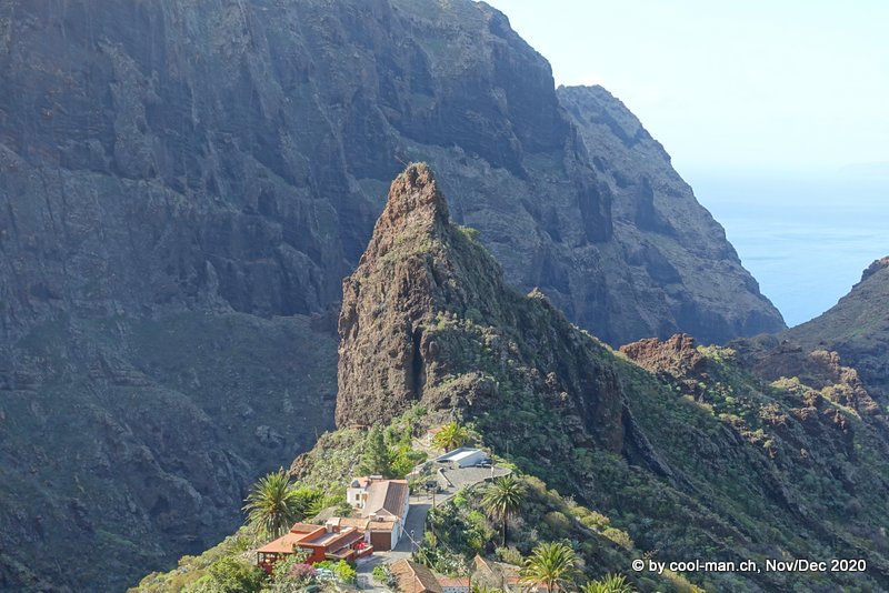
The view from the village upwards …
… and to the opposite side of the valley.
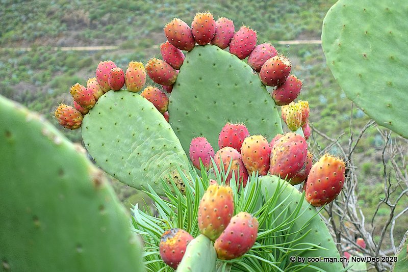
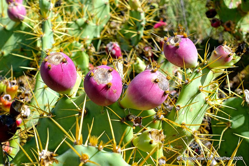
Cactus fruits
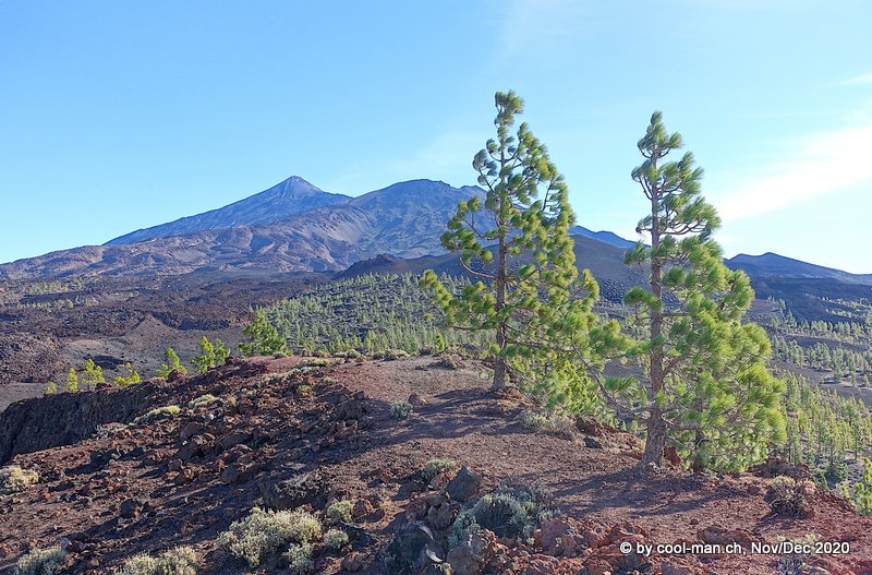
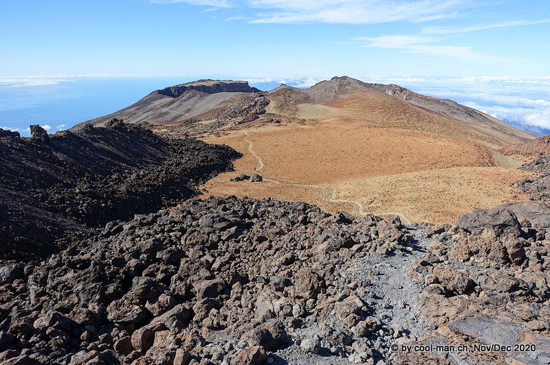
Hiking around the viewpoint Mirador Samara
The next day I planned to do another hike in the Parque Nacional Teide. The tourist information suggested me a hike with starting point Mirador Samara. I followed trails 13, 9 and 32. As the pictures show, I spent a fantastic day.
View over pine forests and lava with the volcano Teide in the background.
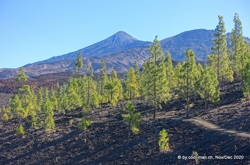
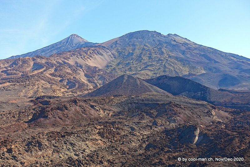
The area was covered by volcanoes and lava of different ages. I could already see the hike planned for the next day from Teide Volcano to Pico Viejo Volcano. Pico Viejo is the elevation on the right side of the picture.
Here I took my lunch break. I was so impressed with the landscape that it was hard to leave.
Just before the end of the hike, I again encountered the pine forest, whose needles seemed to glow in the sun.
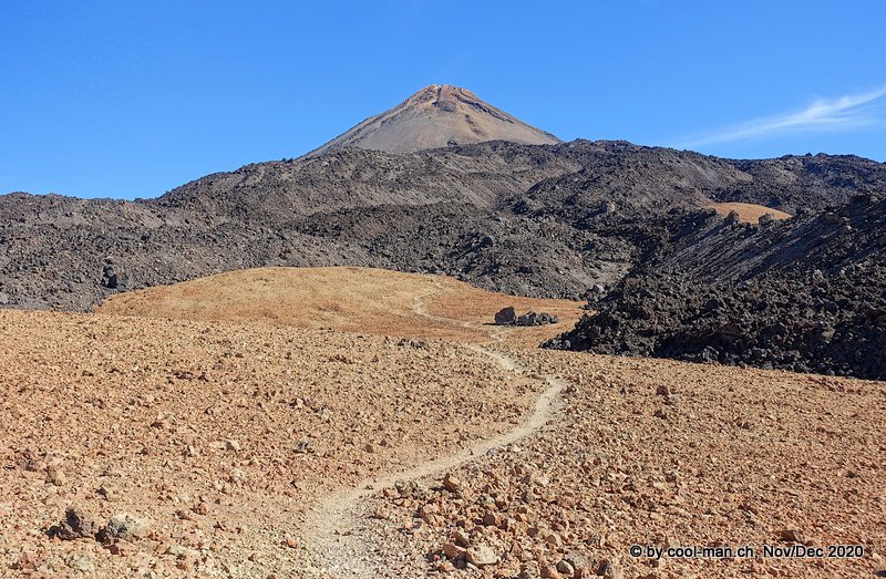
From Mount Teide via Pico Viejo to Parador de Cañadas del Teide
On the last day before my departure I climbed the volcano Mount Teide, the highest mountain in Spain ( 3’715 meters).
We had already obtained permission a few days before to climb the summit between 9 and 11 am. If I wanted to reach the summit on foot from the starting point in the national park, the climb would take about 4-5 hours. From the apartment in Los Cristianos, the drive took about an hour. So if I wanted to be on the summit at 11 o’clock according to my permit, I would have to leave at 6 o’clock in the morning at the latest.
I didn’t do that to myself, so I decided to take the cable car to the top station and hike the last meters up the volcano. Since there were hardly any visitors due to the pandemic, I was able to make the mandatory reservation the night before for the first ride up the mountain the next morning at 9 am.
I parked the car outside the official parking lot of the cable car valley station on the road, as recommended by the park administration, because the official parking lot closes at 4 pm.
There were only a handful of people in the first gondola and I was the only one with a summit permit, so I was the first on the top. Instead of the stated 45 minutes, I reached the peak in 10 minutes.
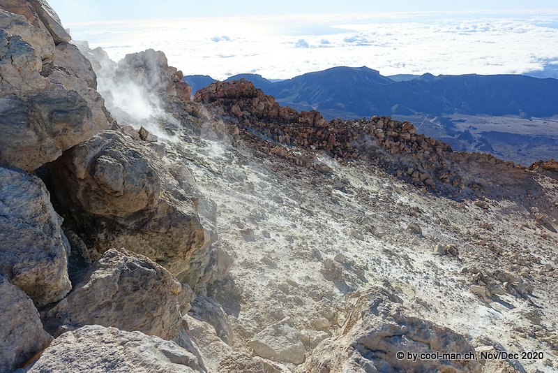
Feelings of happiness arose, all alone to enjoy the peace and quiet on the summit. There was a breathtaking view over the island and the crater, which was partly shrouded in sulfur vapors.
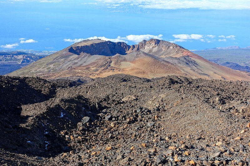
Since I went up by cable car, I wanted to make the descent via the extinct volcano Pico Viejo on foot.
A view back to the volcano Teide, from whose top I just came.

In front of me, the volcano Pico Vieja appeared in full splendor.
The hiking trail to Pico Viejo
And again a view back to the volcano Teide
After a lunch break at Pico Viejo, I continued the descent to the Parador de Cañadas del Teide. At 4 p.m. a bus drove from the Parador to the valley station of the cable car, where I had parked my car. This superb hike was the perfect end to my great seven-week trip to the three Canary Islands of La Palma, La Gomera and Tenerife.
The next day I flew back to Switzerland. For me, the Canary Islands were the epitome of mass tourism and without the pandemic I would not have visited these islands. I was all the more surprised by the landscapes and how easy it was to avoid the mass tourism, which had already decreased considerably due to the pandemic.
After 10 days in wintry Switzerland with Christmas and New Year’s Eve celebrations, I traveled again to the warmth, this time to the Cape Verde Islands.
This text is an automatic English translation from the German original by deepl.com